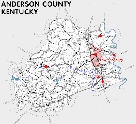
Anderson county is in the Outer Bluegrass region of Kentucky. The elevation in the county ranges from 469 to 940 feet above sea level.
It was formed in 1827 from Franklin, Mercer, and Washington counties. The county seat is Lawrenceburg.
In 2020 the county population was 23,852 in a land area of 201.83 square miles, an average of 118.2 people per square mile.
The equine population was 1,400 in the 2012 Kentucky Equine Survey.
Anderson county is in the Frankfort micro statistical area and the Bluegrass Area Development District.
Anderson county was named for Richard Clough Anderson, Jr., member of the Kentucky and United States legislatures and diplomat.


SEARCH THE KENTUCKY ATLAS & GAZETTEER
© 2024 David C. Elbon
