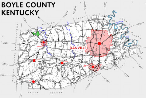
Boyle county is in the Bluegrass region of Kentucky. The elevation in the county ranges from 740 to 1364 feet above sea level.
It was formed in 1842 from Lincoln and Mercer counties. The county seat is Danville.
In 2020 the county population was 30,614 in a land area of 180.17 square miles, an average of 169.9 people per square mile.
The equine population was 2,000 in the 2012 Kentucky Equine Survey.
Boyle county is in the Danville micro statistical area and the Bluegrass Area Development District.
Boyle county was named for John Boyle, who served as a Kentucky legislator and judge, including over 15 years as Kentucky chief justice and several years as a Federal judge.


SEARCH THE KENTUCKY ATLAS & GAZETTEER
© 2024 David C. Elbon
