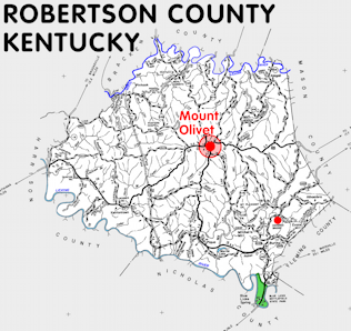
Robertson county is in the Outer Bluegrass region of Kentucky. The elevation in the county ranges from 550 to 1009 feet above sea level.
It was formed in 1867 from Bracken, Harrison, Mason, and Nicholas counties. The county seat is Mount Olivet.
In 2020 the county population was 2,193 in a land area of 99.91 square miles, an average of 21.9 people per square mile.
It is the smallest county and the least populous county in the state.
The equine population was 400 in the 2012 Kentucky Equine Survey.
Robertson county is in the Buffalo Trace Area Development District. It is in the Appalachian region according to the Appalachian Regional Commission.
Robertson county was named for George Robertson, legislator and judge.


SEARCH THE KENTUCKY ATLAS & GAZETTEER
© 2024 David C. Elbon
