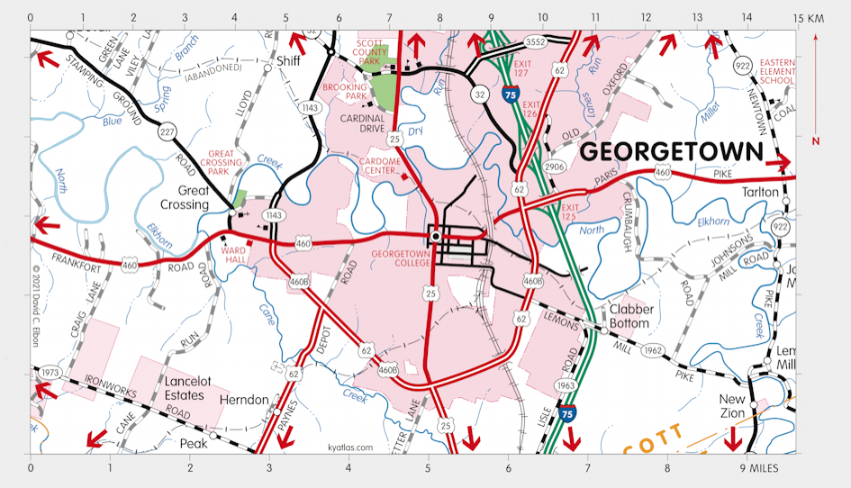
Georgetown, Kentucky

Georgetown, the seat of Scott county, is located near the center of the county at Royal Spring and North Elkhorn Creek. Although the area had a few settlers as early as 1775, the permanent settlement that became Georgetown began in 1776 as McClellan's Fort or McClellan's Station, named for the McClellan family. About 1782 it was renamed Lebanon Station and was incorporated as Lebabon by the Virginia assembly. In 1790 the new town was named George Town, to honor George Washington. It was made the Scott county seat when the county was formed in 1792.
The Georgetown post office opened in 1801.
The population in 2020 was 37,048.

Georgetown is the home of Georgetown College, founded in 1829.

The Scott County Courthouse in Georgetown, the county's fourth, was completed in 1877 and renovated in 1996.
A major employer in Scott county is Toyota Motor Manufacturing, Kentucky (TMMK).

Just west of Georgetown on the Frankfort Pike (US 460) is Ward Hall, a Greek Revival mansion completed about 1857 for Junius Richard Ward. The design has been attributed to Thomas Lewinski, a Lexington architect. The Ward Hall Preservation Foundation owns the building and grounds and is working toward its restoration.
MORE INFORMATION
- Cardome Center
- Georgetown, City of
- Georgetown-Scott County Chamber of Commerce
- Georgetown-Scott County Parks
- Georgetown-Scott County Tourism
- News-Graphic
- Scott County Clerk
- Scott County Fiscal Court
- Scott County Public Library
- Scott County Schools
SEARCH THE KENTUCKY ATLAS & GAZETTEER
© 2026 David C. Elbon