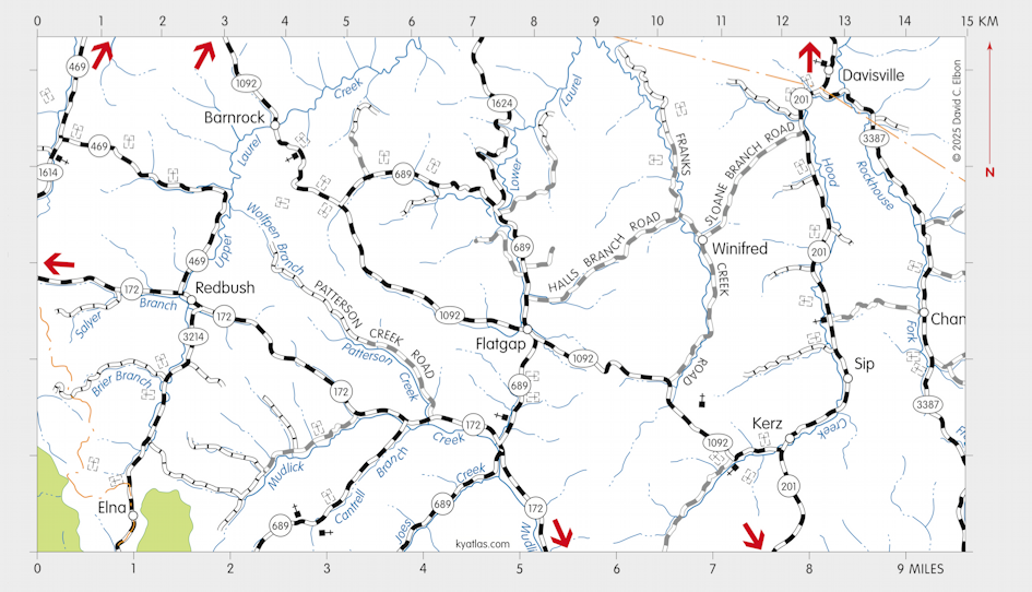
Flatgap, Kentucky

Flatgap is a Johnson county community about 11 miles northeast of Paintsville on Lower Laurel Creek. The name comes from the divide between Lower Laurel Creek and Mudlick Creek.
A Flat Gap post office opened in 1873 and by 1894 was spelled Flatgap.
SEARCH THE KENTUCKY ATLAS & GAZETTEER
© 2025 David C. Elbon