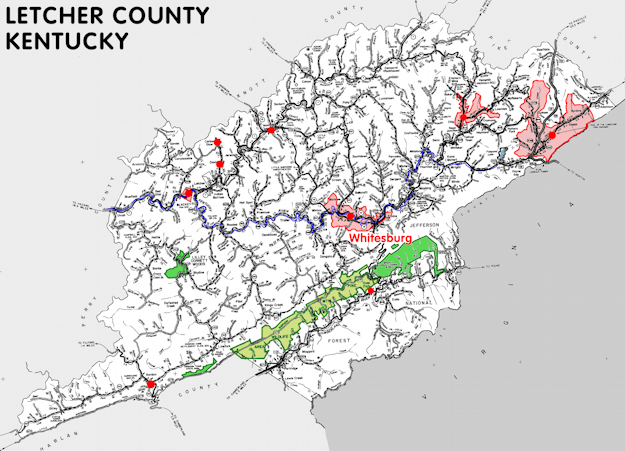
Letcher county is in the Eastern Coal Field region of Kentucky. The elevation in the county ranges from 940 to 3720 feet above sea level.
It was formed in 1842 from Harlan and Perry counties. The county seat is Whitesburg. Letcher county was a source of Knott (1884) county.
In 2020 the county population was 21,548 in a land area of 337.91 square miles, an average of 63.8 people per square mile.
The equine population was 200 in the 2012 Kentucky Equine Survey.
Letcher county is in the Kentucky River Area Development District. It is in the Appalachian region according to the Appalachian Regional Commission.
Letcher county was named for Governor Robert P. Letcher.
Coal mining has long been the principle industry in the county and several of its towns, including Jenkins, Fleming, and McRoberts, began as mining camps.
Letcher county was the setting for the early twentieth century novels The Little Shepherd of Kingdom Come and The Trail of the Lonesome Pine of John Fox, Jr. Kingdom Come State Park is located in the southwest of the county on the border with Harlan county. Lilley Cornett Woods, one of the largest tracts of protected old-growth forest in the state, is located in the county.


SEARCH THE KENTUCKY ATLAS & GAZETTEER
© 2026 David C. Elbon
